

Esplorazioni
- Nanni Acquarone

- 8 set 2012
- Tempo di lettura: 15 min
Nanni
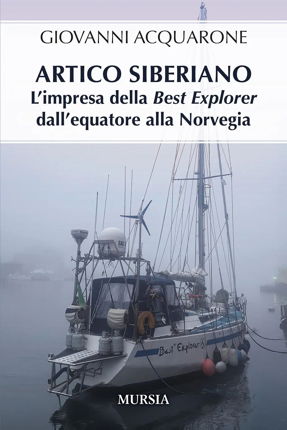
Il nostro viaggio ci lascia poco tempo per guardarci intorno: troppe miglia da percorrere e date fisse da rispettare per i cambi di equipaggio. La nostra pianificazione è stata buona fino a Gjøa Haven e abbiamo rispettato fin lì tutti i nostri appuntamenti. Più oltre, la possibilità di trovare la rotta bloccata dai ghiacci aveva suggerito un piano ancora più prudente. Di fatto abbiamo trovato la rotta oltre Gjøa Haven completamente libera da ghiacci e in più abbiamo beneficiato di diversi giorni di tempo soleggiato e calmo. Pur costringendoci ad usare sempre il motore, ci ha fatto viaggiare a una media di 160-170 miglia al giorno invece delle previste 70. Sicché abbiamo accumulato un sacco di tempo per fermarci da qualche parte prima di arrivare a Tuktoyaktuk. Quando si viaggia in una zona turistica si trovano comunemente moltissime informazioni sulla costa, sui suoi porti e baie, sui punti interessanti, le possibilità di rifornimento di acqua e carburante e di qualunque altra cosa vi venga in mente. Qui non è così. Pensate che su una costa di trecento miglia, più o meno la dimensione della Manica e più della distanza tra Genova e la frontiera spagnola, che occupano più portolani interi, qui ci sono poche decine di pagine di descrizione. Si direbbe proprio che qui si debbano affrontare diverse difficoltà. Tanto per citarne qualcuna, posti che sembrano riparati potrebbero non permettere l'accesso perché l'acqua è troppo bassa (lungo la costa ci sono ben pochi sondaggi). Il fondo potrebbe essere troppo profondo o troppo roccioso o pieno di alghe per una tenuta sicura dell'ancora. Le previsioni del tempo sono assolutamente inaffidabili, rendendo la decisione di avvicinarsi a costa di per sé un affare assai rischioso. E' però molto stimolante andare a esplorare un posto nuovo e trovare il proprio percorso in una zona sconosciuta. E così, noi ci andiamo in quei posti. Il peggiore dei tre che vi descriverò, comincio da questo, è stata una laguna aperta posta dietro un'isola dove ci siamo riparati perché non avevamo alcun desiderio di continuare a navigare contro mare e vento, come stavamo facendo da più di venti ore. Il portolano lo indicava come un posto dove qualche imbarcazione aveva superato in sicurezza "diverse tempeste da ovest" con "un fondo buon tenitore" e con il nome piacevole di "Snowgoose passage" (il passaggio delle oche delle nevi"). Il fondo era buon tenitore davvero, ma il mare da ovest sollevato dal vento oltrepassava la bassa barra di sabbia che proteggeva la laguna rendendoci la notte particolarmente scomoda e obbligandoci addirittura a levare l'ancora la mattina seguente e scappare via. La sera prima abbiamo affrontato le onde e calato il canotto per andare a fare quattro passi a terra. Che desolazione! Una terra piatta coperta da una tundra giallastra, rive ripide fangose e franose che scivolano nel mare sotto i colpi delle onde, piccoli stagni di acque superficiali sparsi dappertutto, pur lasciando la gran parte del terreno ragionevolmente asciutto in quest'inizio di autunno. E per fortuna non ci sono più zanzare! Dopo un atterraggio con qualche difficoltà a causa dei frangenti sulla spiaggia fangosa, scopriamo le tracce recenti di un orso. Pensiamo fosse un grizzly, perché abbiamo poi trovato nella tundra un bel po' di zolle rivoltate con le sue impronte, un comportamento inusuale per un orso polare. La scoperta delle tracce ci rende prudenti e ci mettiamo a camminare contro vento, per evitare di allertare eventualmente l'animale col nostro odore, fucile alla mano. Vediamo quasi subito alcuni caribù vicino al mare dall'altra parte dell'isola. Sono curiosi e non scappano come ci aspetteremmo, mentre ci allunghiamo sulla pancia per non allarmarli, forse un segno favorevole dell'assenza di orsi nelle vicinanze. Poco dopo, sulle falesie sopravvento, pericolose perché instabili per l'erosione delle onde, scopriamo i segni del permafrost in una spaccatura, sotto forma di uno strato di ghiaccio lucido che giace mezzo metro sotto al superficie del suolo. Pernici e oche fan sì che quest'isola appaia più viva di altre terre che abbiamo visto nei mesi scorsi. Di ritorno in barca issare canotto e motore non è facile. Onde di un metro circa fanno impennare barca e canotto mentre tentiamo di assicurare il motore alla barca dopo un balzo acrobatico a bordo, avendo però messo prima al sicuro le nostre cose, fucile e macchine foto per primi. La sera successiva il vento si è calmato del tutto mentre ci inoltriamo in un'altra baia, Johnson Bay, una quarantina di miglia a ovest dell'ancoraggio precedente. Lo scenario è simile, ma l'atmosfera del tutto diversa. Forse per via della calma, forse per l'idea di ripararsi in un ancoraggio protetto, ma ci sentiamo molto più attratti dal posto. Immaginate un costa piatta lunga diverse decine di miglia e alta appena una decina di metri e rive ripide e fangose come nell'isola precedente. Di colpo scorgete un passaggio stretto e profondo che porta dentro la terra. Sapete che in fronte all'entrata, avendo consultato le carte, c'è una barra di sabbia sottomarina che bisogna evitare e perciò avanzate lentamente con un occhio al sonar che vi dà l'idea di cosa vi potrete aspettare davanti alla barca. Il fondo è di soli quattro metri e si alza. Tre e cinquanta, tre e trenta, tre, due e ottanta: rallentate. Il GPS, il nostro sistema principale di navigazione, non si accorda bene con la carta: c'è almeno un decimo di miglio di differenza. Non sembra molto, ma ci posiziona sulla terra, se dovessimo credergli. Certamente non vi preoccupate per quest'inezia, ma dove siete in realtà? Siete sicuri dei rari sondaggi che leggete sulla carta e della loro precisione? Al di là dell'errore di posizione? Per cui andate avanti come avreste fatto cento anni fa, a vista e misurando le profondità. Alla fine entrate nella baia tra due lingue di sabbia con dei ganci verso l'interno e vi ancorate in due metri e cinquanta di acqua dietro il gancio a nord. E' marea alta, lo deduciamo dai segni sulla spiaggia. La marea qui dovrebbe essere di trenta centimetri, siamo tranquilli. Gabbiani e oche sono fermi sulla sabbia e ci sono pernici sulla terra. Vediamo di lontano alcuni caribù che brucano nell'interno. Una foca gioca accanto a noi nell'acqua e viene ancora più vicino per vedere che razza di strani animali siamo. C'è silenzio tutt'intorno. Il sole tramonta in un cielo senza nuvole. Più tardi nella notte a bassa marea la barca tocca sul fondo con colpi attenuati, solo grazie al nostro ridotto pescaggio di un metro e quaranta, alla faccia della marea prevista. La mattina dopo pioviggina mentre salpiamo e torniamo attentamente sui nostri passi seguendo il GPS e uscendo da questo magico posto. Ma la migliore esperienza delle tre l'avevamo fatta un paio di giorni prima. Stavamo discutendo se fermarci nella prossima baia, indicata dal portolano come il miglior riparo in questo tratto di costa, oppure continuare verso la nostra destinazione per non rischiare di essere bloccati da qualche possibile mal tempo, visto che eravamo a circa duecento miglia di distanza. Un'improvvisa violenta brezza da terra ci ha reso facile la decisione e ci siamo fermati lì. Stava diventando buio, perché ormai i giorni senza notte erano solo più un ricordo, e l'ingresso in un posto sconosciuto e sempre un po' rischioso in queste condizioni. C'era tuttavia ancora un barlume di luce in cielo per aiutarci. Una forte corrente contraria ci rallenta. Siamo tutti in coperta a guardare: entrare in un posto nuovo è sempre una ragione di grande aspettativa. L'ombra più scura della riva rocciosa si può indovinare sullo sfondo scuro del cielo, col mare solo una sfumatura più chiaro. Di nuovo il GPS sbaglia, dicendoci che stiamo navigando sulla terra. Ci inoltriamo nella baia cercando di individuare un isolotto roccioso sulla nostra dritta: è unito a terra con una linea di bassifondi e dobbiamo evitare di passarci sopra. Eccolo! Direttamente al nostro traverso a dritta: siamo al sicuro! L'ancoraggio che ho individuato è allineato con una punta di sassi chiamata Police Flat, bassa e con poca acqua intorno. Non riusciamo a vederla, neppure col nostro faro. Cerco di capire dove siamo dalla forma delle colline intorno a noi e dalle indicazioni dello scandaglio. Do l'ordine di dar fondo all'ancora in sette metri d'acqua. Sono venti minuti dopo mezzanotte. Notte calma. La mattina dopo è scintillante. Possiamo finalmente vedere la forma del posto nelle sue condizioni migliori. Mettiamo in acqua il canotto e andiamo a terra sbarcando a Police Flat, questa lingua di pietre con un'estesa area di acqua bassa alla sua estremità. Sulla cima c'è una capanna cadente, si direbbe che viene usata raramente e c'è perfino una canna da pesca in buone condizioni appoggiata alla sua parete fuori della porta. Un porta interna è aperta ma bloccata dall'età. Possiamo guardare attraverso ai vetri. C'è una stanza in disordine con qualche mobile e tracce di un utilizzo recente. All'esterno cerniere rugginose, pulegge, cavi, rubinetti, perfino un utensile da cucina e diverse cucce per cani da slitta in cattive condizioni. C'è una strada sterrata che porta a un'altra casa in cima a una breve valle. Al suo inizio qualcuno ha posto su una pietra il cranio di un bue muschiato, segno della stranezza dei luoghi. Ci sono strade dappertutto. Il fondo sterrato coperto di pietre scavate dai lati delle colline circostanti. la casa è vuota così come un altro magazzino in cima alla collina. Una targa ci informa che questa era una stazione di ricerca, evidentemente abbandonata da molti anni. La fatiscenza degli edifici non riesce a incidere sulla nostra allegria. Ci dirigiamo su delle rocce piatte che ci portano a un'altura sulla baia. Dalla cima ci godiamo uno spettacolo meraviglioso. La baia, Pearce Point Harbour, è a forma di ovale quasi perfetto rinchiuso da due capi rocciosi. I lati dell'ovale sono di spiagge sabbiose. Dietro di quella orientale una piana sconfinata con solo alcune colline vicine. Quella occidentale è contornata da basse falesie rocciose. Dal nostro osservatorio l'isolotto roccioso che temevamo tanto ieri si trova nel centro della baia con pareti verticali e un buco nel centro in basso attraverso di cui si vede l'acqua e della luce. Sotto di noi una baia nella baia protetta dalla punta di sassi. Il nostro sguardo si posa lontano verso est, dove la lunga costa diritta si estende fino all'orizzonte. Quando ci voltiamo ci aspetta una sorpresa: dietro di noi c'è una collina cilindrica con pareti verticali. Ci avanziamo per vedere meglio e scopriamo che la collina sorge da un grande lago calmo separato dalla baia successiva a ovest da una sottile e lunga spiaggia: davvero sorprendente! Nel lago ci sono anatre e foche. E' un pezzo di Monument Valley trasportata nell'Artico. Ci fermeremmo qui per sempre, ma vogliamo continuare la nostra esplorazione. Di ritorno alla baia nella baia seguiamo lentamente la strada che porta verso est. Scopriamo subito le tracce di due orsi. Porto con me un fucile per protezione, ma preferiamo tornare sui nostri passi al gommone: gli orsi polari sono curiosi e qualche volta, se uno di loro si trova a passare vicino, potrebbe distruggere il gommone e impedirci così di tornare alla barca (portiamo con noi anche il telefono satellitare per chiamare aiuto, se necessario). Sul gommone ci avviciniamo all'isolotto e allegri come dei bambini passiamo attraverso al buco. Alla fine, dopo aver indagato su una macchia bianca sulle rocce di una delle punte che proteggono la baia, era solo una roccia bagnata, andiamo a passeggiare sul pianoro a est, scoprendo ulteriori laghetti e corna di caribù, prima di tornare su Best Explorer. L'indomani salpiamo presto nella nebbia fitta. Siamo stati eccezionalmente fortunati ad essere qui in una giornata così bella. Our trip leaves us little time for looking around: there are too many miles to travel and we have fixed dates and places where we have to be. Our planning has been good until Gjoa Haven and we have met our appointments in good time. From there on, the possibility of finding our route blocked by the ice suggested a more conservative timetable. At the end we found the way beyond Gjoa completely ice free and on top we enjoyed several days of calm and sunny weather. While this meant motoring all the way, it meant also travelling at an average of 160 to 170 miles per day instead of the foreseen 70. So, before arriving in Tuktoyaktuk, we had plenty of time to stop in a few places. When you happen to sail in a touristy area, you normally find a wealth of information on the coast, its harbours and coves , the places of interest, the fuelling and watering possibilities and any other fancy ideas you can imagine. Here it is not so. Think that a coast of three hundred miles, more or less the length of the English Channel or more than the distance between Genova, in Italy, and the Spanish border, is described in just a few pages of the sailing directions instead that in several books. You definitely find some challenges there. Just to mention a few of them, places that seem to be sheltered may not be accessible because of shallow waters (there are only few soundings along the coast). The bottom could be too deep or too rocky or full of seaweed to allow a safe anchorage. The weather forecast is totally unreliable, making the decision to get too near the coast a very risky business. It is nevertheless extremely exciting exploring a new place and finding your own way around. So, we went into three such places. The worst of them, I'll start with that, was an open lagoon behind an island where we went not having any wish to continue sailing against head winds and sea, as we were doing since almost twenty hours. The sailing directions said that some craft rode "several westerly gales" in this anchorage, providing "good holding ground" and with the nice name of "Snowgoose Passage". The holding ground was actually good, but the westerly sea raised by the wind was overflowing the low sand bar protecting the lagoon and we experienced a very uncomfortable night, obliged in the morning to lift the anchor and run away. The evening before we braved the waves and lowered the tender going ashore for a walk. What a desolate island! A flat expanse of yellowish tundra, steep muddy sides sliding into the sea under the action of the waves, small ponds of surface water everywhere leaving however the majority of the land passably dry in this beginning of autumn. And no mosquitoes any more, luckily! We had some difficulty to land because of the breakers on a muddy beach where a bear had recently left its tracks. We suspect it was a grizzly bear, as on the tundra flat many sods were turned upside down, a behaviour unusual for a polar bear. The discovery of the tracks made us wary and we marched against the wind, to avoid alerting the animal of our presence on the island, rifle ready in our hand for a final protection. Soon we spotted some cariboos near the sea on the other side of the island. They were curious and did not run away as we expected, squatting low on the ground to avoid alerting them, a possible welcome sign of the absence of bears. Later, on top of the cliffs on the windward side, the edges dangerously unsafe crumbling under the erosion of the waves, we saw the evidence of the underlying permafrost in a ravine, as a thick layer of shining ice emerging under half a meter of soil. Ptarmigans and geese helped to make this island appear more alive than any other land we saw in the previous months. Raising the tender and its motor at the end of our trip wasn't a simple task. Waves of almost one meter sent the boat pitching and rolling while we tried to secure the motor after a somewhat acrobatic jump on board Best Explorer, having previously transferred our belongings, cameras and rifle in particular. Next evening, the wind having abated, we sailed into an inlet, named Johnson Bay, some forty miles west of our previous anchorage. The scenery was similar, but the feeling completely opposite. May be it was the calm weather, may be the idea of getting into a more protected place, but we felt much more attracted by this anchorage. Imagine a flat coast several tens of miles long and just some ten meters high, muddy steep shores as in the previous island. Unexpectedly you see a narrow passage entering deep into the land. You know by the map that in front of the entrance there is a sand bar under the water that you have to skirt and thus you proceed slowly, watching the sonar that is giving you an idea of the bottom in front of you. The bottom itself is a mere four meters deep, and shallowing. Three fifty, three twenty, three, two eighty. You slow down. The GPS, our main navigation system, does not fit with the map: there is at least a tenth of a mile difference. It does not seem much, but we are sailing on land, according to the map. Of course you may not be worried by that, but are you sure of where you are? Are you sure of the scarce soundings you see on the map and of the accuracy of it, apart from your position? So you carry on as you might have done a century ago, by sight and by soundings. Finally we enter the bay between to spits of sand hooked toward the inside and we anchor in two meter fifty water behind the northern hook. It is high tide, we can tell it from the signs of the sea on the beach. Tide range should be thirty centimetres here, we should be safe. Gulls and geese are on the sand and ptarmigans on shore. Far away we can see some caribous grazing inland. A seal plays in the water and comes nearby to see what kind of strange animals we are. Silence all around us. The sun sets in a cloudless sky. Later during the night at low tide we feel the boat hitting the bottom with gentle touches, thanks to our shallow draught of one meter forty and thanks to the foreseen tide range! In the morning it rains a little while we raise anchor and retrace our path on the GPS to exit safely from the bay. Wonderful place. The greatest experience of these three we had was a couple of days before. We were debating whether stopping in the next bay, considered by the sailing directions the best harbour in the stretch of the coast, or to continue to our destination not to risk being stuck there by a possible bad weather, some two hundred miles away from our destination. A sudden violent shore breeze made us decide to stop there. It was getting dark, the nigthless days now gone forever, and the entrance in an unknown place always somewhat risky in such a condition. Still, there was some faint light in the sky to help us. A strong current against us is slowing our progress. Everybody is on deck watching: the expectation is high as usual, The dark shadows of a rocky land can just be imagined against a dark sky, the sea only a little lighter. Again, the GPS faulting, the instruments tell us that we are sailing on land. We get inside the bay and try to detect a rocky islet on our starboard: it is connected to the land by a line of shoals and we have to avoid running into them. There it is, right on our starboard beam: we are safe! The anchorage I selected is in line with a spit of sand called Police Flat, low and shallow. We can't see it, not even with our search light. I try to understand our position from the shapes of the hills around us and from the echo sounder that gives me a the depth of the water. I give the command to drop the anchor in seven meters depth. It is twenty minutes after midnight. Quiet night. The following day is glorious. We can see the shape of the place in its more favourable conditions. We lower the tender and go ashore landing in Police Flat, a spit of gravel with an extensive drying area at its tip. A decaying hut is built at the head of it, it is probably used some times and there is even a fishing rod in good conditions on the outside of the door. An inside door is unlocked but stuck by the age. We can see through the glasses. Inside is an untidy room scarcely furnished with traces of a recent usage. Outside rotten metal hinges, pullies, cables, taps, even a kitchen tool and several dog huts in bad conditions. There is a dirt road leading to another house up a short valley. Where it starts somebody has put the skull of a muskox on a stone, a reminder of the strangeness of the country. Actually there are roads everywhere. Their bottom made of gravel dug from the sides of the surrounding hills. The house is empty as it happen for a warehouse higher up the hill. A post tells us that it was a research station, clearly abandoned since many years. The shabbiness of the buildings fails however to lower our spirits. We direct our steps over the flat rocks leading to a hill overlooking the bay. From the top of the rocky hill we enjoy a wonderful view. The bay, Pearce Point Harbour, is shaped as an almost perfect oval included between two dark rocky heads. The sides of the oval are made by sandy beaches. Behind the eastern one there is an unlimited flat with just a few low hills nearby. The western shore is limited by steep low rocky cliffs. From our viewpoint the rocky islet that we feared so much yesterday stands in the middle of the bay with vertical sides and has a hole in the middle of its bottom part, through which we can see light and water. Below us a bay within the bay protected by the gravel spit. Our eyes look far to the east beyond the plain, where the long linear coast extends to the horizon. We stay there for long minutes enjoying the landscape. When we turn back we are in for a surprise: behind us there is a cylindrical hill with vertical sides. We step forward to examine it better and we discover that the hill raises from a quite large lake that is separated from another bay on the west side by a thin long sandy beach: amazing! In the lake there are ducks and seals! It's a small bit of the Monument Valley transplanted in the Arctic. We could stay here forever, but we want to continue our exploration. Back on the bay within the bay we follow leisurely the road leading to the east. We soon discover the fresh tracks of two bears. I carry a gun for protection but we prefer to go back to our tender: polar bears are curious and if some of them is wandering around it could destroy the raft playing with it and preventing us from reaching the boat (we carry with us a satellite phone to call for help, just in case). On the tender we approach the islet and the kid hidden within our hearts pushes us to navigate through the hole. Finally, after investigating a white spot on the rocks of one of the points protecting the bay, it was just a wet rock, we stroll on the eastern plain, discovering ponds and cariboo antlers, before returning to Best Explorer. The following day we leave early in a thick fog. We ave been extremely lucky to be here on such a beautiful day.


Commenti